The result of a 2D imaging survey is a model presented in the form of pseudosection of the underground.
![]() Example of 2D imaging tomography, rock glacier,
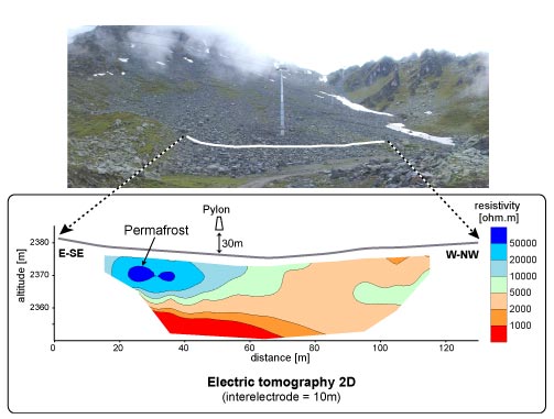
Example of 2D imaging tomography, rock glacier,
Verbier, Switzerland ( IGL document)
|
The result of a 2D imaging survey is a model presented in the form of pseudosection of the underground.
|